Experiments in Correlative Ontography, Montreal
As a teenager in the 1960s, I took the train from my suburban town to Penn Station in New York City, spending the day walking, photographing and visiting museums. I’ve continued to employ my camera to understand my relationship with cities ever since.
In 2010, the city was Montreal: I was invited by a department of geography (at Concordia University) to participate in a collaborative workshop that explored the intersection of science and art. We all worked from a common database created for the purpose of exploring environmental conditions and health effects across the city of Montreal. Our aim was to explore forms of spatial expression that could enrich the understanding of geographic phenomena.
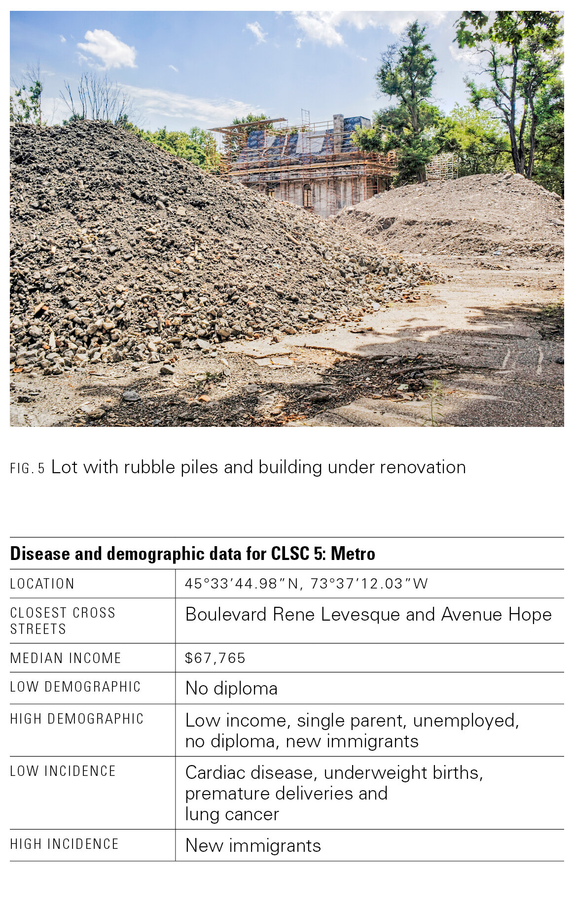
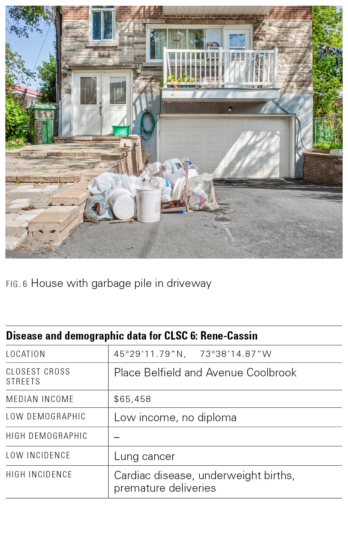
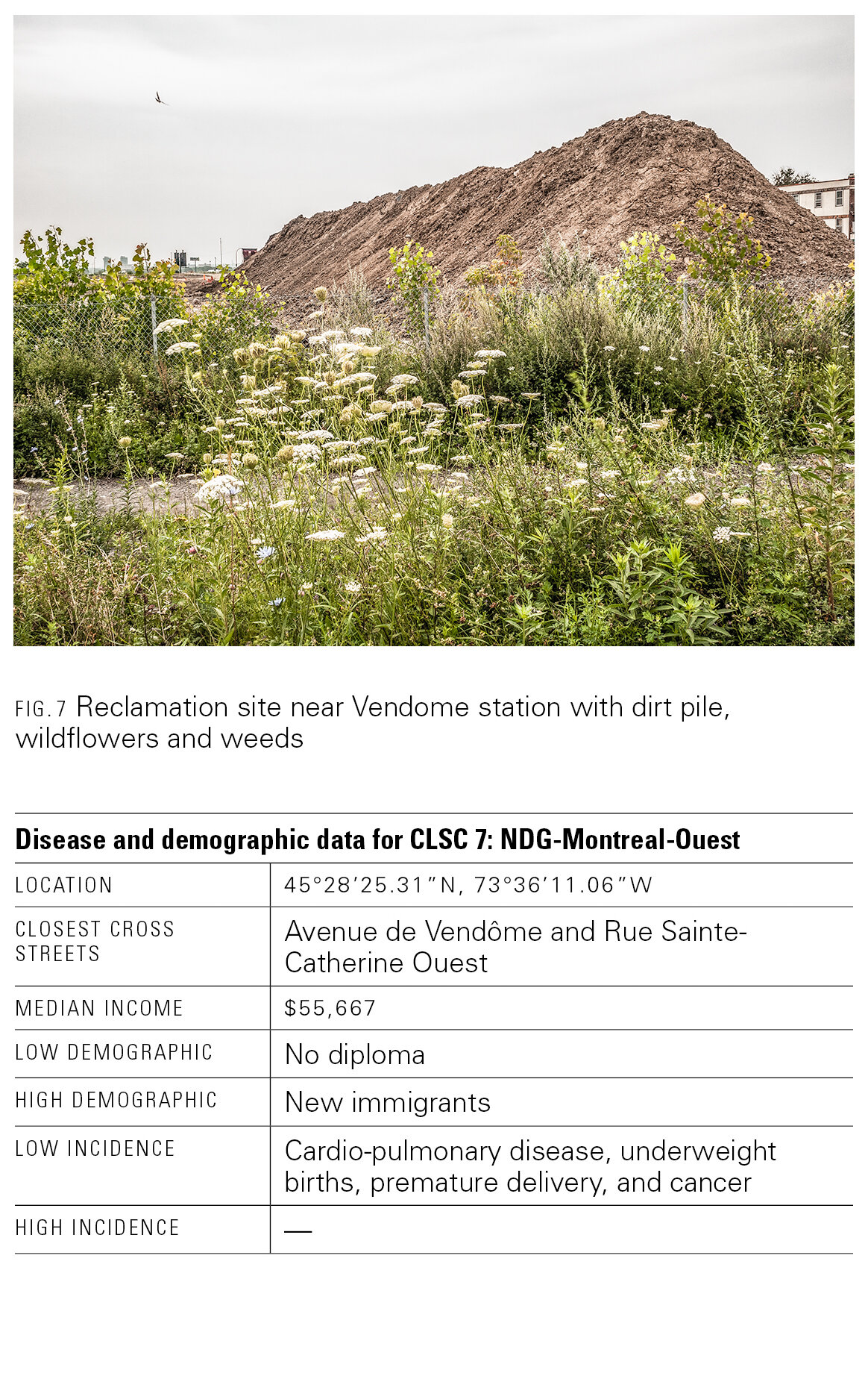
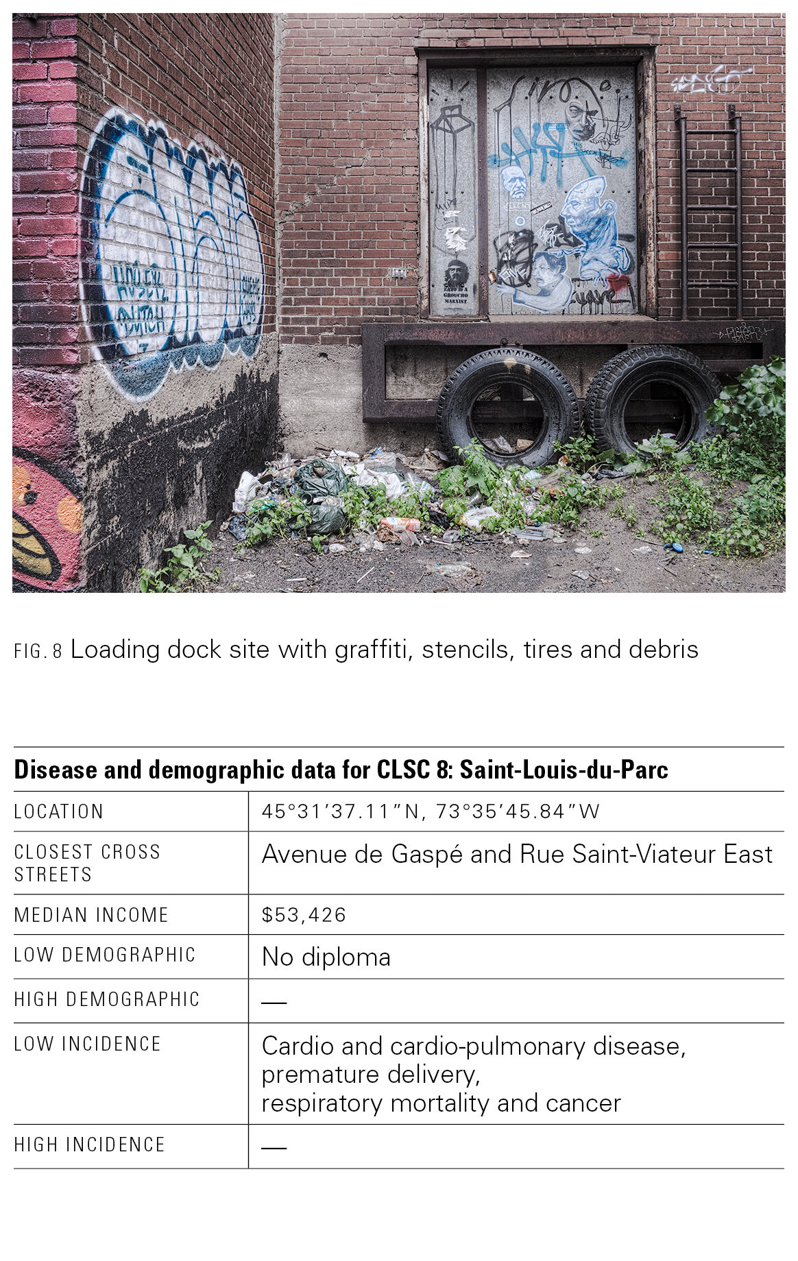
I proposed Experiments in Correlative Ontography with the idea of employing the practice of photographing the city as a “constant” to document the different health districts that were used to organize the geographic component of the database. The broad question I asked: what can be observed under the rubric of scientific data?
Essays resulting from the workshop are collected in the academic book, Mapping Environmental Issues in the City (Springer, 2011). Below you will find the photographs with accompanying tables as found in the book, as well as a wall display panel that uses a longer version of the text, allowing for more sustained philosophical reflection. Both can be found on the “Thinking with Words” section of this website.


Experiments in Correlative Ontography | John Calvelli | 2010 | Full-text pdf | Short version pdf
![Abandoned building [1/14]](https://images.squarespace-cdn.com/content/v1/5eb708e16d69f33f387b0630/1597949586152-9LXX6ASJE095WCAO73SM/onto-montreal-1.jpg)
![Ich ["I"] [2/14]]](https://images.squarespace-cdn.com/content/v1/5eb708e16d69f33f387b0630/1597949586238-8QI0T5UOS5BSRNCHTTJJ/onto-montreal-2.jpg)
![Loading dock site with graffiti, stencils, tires and debris [3/14]](https://images.squarespace-cdn.com/content/v1/5eb708e16d69f33f387b0630/1597949587950-PZU7RHRES4CUZC97F87H/onto-montreal-3.jpg)
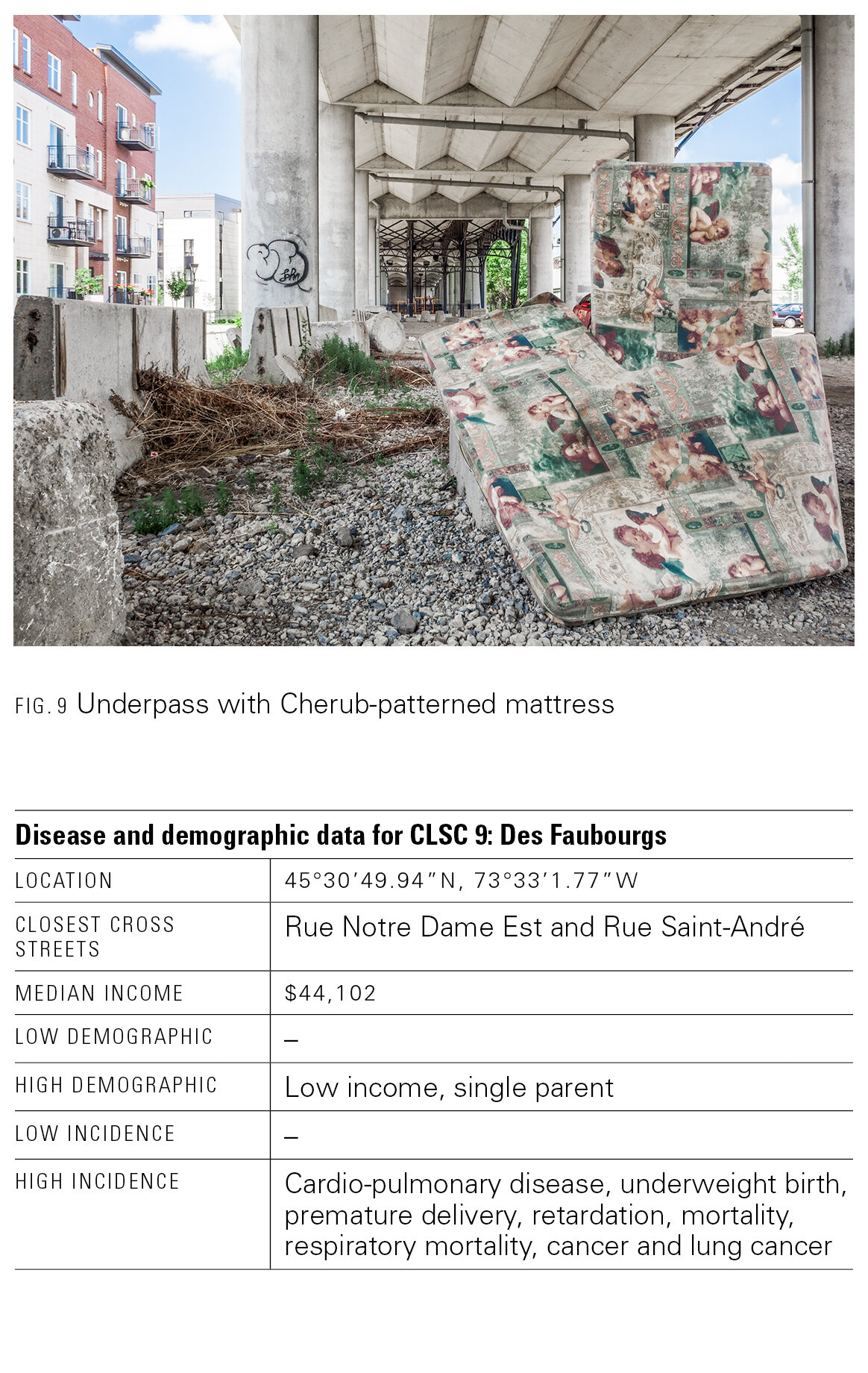
![Underpass with cherub-patterned mattress [4/14]](https://images.squarespace-cdn.com/content/v1/5eb708e16d69f33f387b0630/1597949580929-CHG3N8KDT0EIHBC1S4B1/onto-montreal-4.jpg)
![Lot with real estate placard and adjoining buildings [5/14]](https://images.squarespace-cdn.com/content/v1/5eb708e16d69f33f387b0630/1597949580613-R0RZM7EQ9G51CEQ867IZ/onto-montreal-5.jpg)
![House with garbage pile in driveway [6/14]](https://images.squarespace-cdn.com/content/v1/5eb708e16d69f33f387b0630/1597949581017-V6T38FHA1WIO7FDFVX8N/onto-montreal-6.jpg)
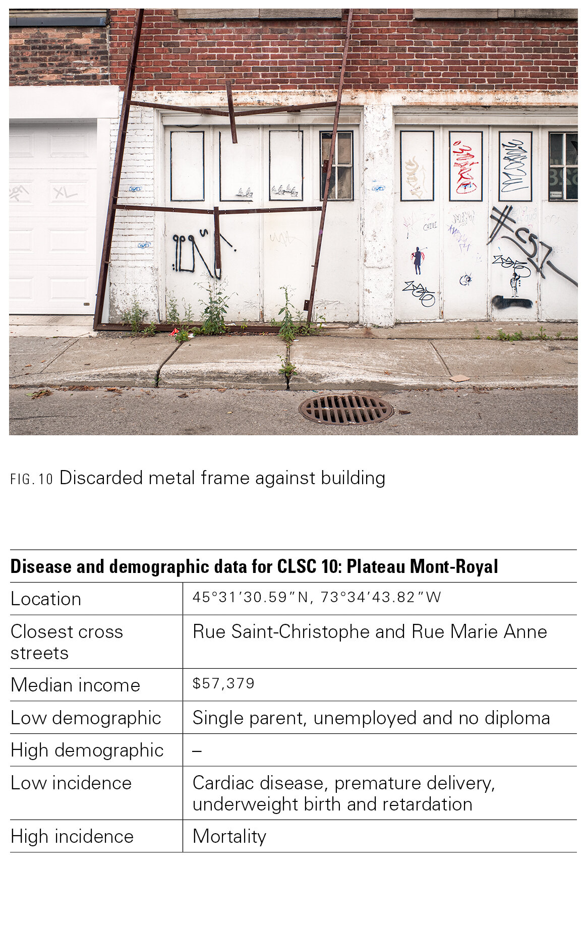
![Discarded metal frame against building [7/14]](https://images.squarespace-cdn.com/content/v1/5eb708e16d69f33f387b0630/1597949578125-8GKC77YEUJEC1UUIWPCB/onto-montreal-8.jpg)
![Stuffed mailboxes near doorway of house [8/14]](https://images.squarespace-cdn.com/content/v1/5eb708e16d69f33f387b0630/1597949570969-C7UKOK2VSN0DPXHQ3086/onto-montreal-7.jpg)
![Industrial site from security fence with vegetation, buldings and other structures [9/14]](https://images.squarespace-cdn.com/content/v1/5eb708e16d69f33f387b0630/1597949562290-JF2OB2L1DS77UJF6YR87/onto-montreal-10.jpg)
![Painted buildings [10/14]](https://images.squarespace-cdn.com/content/v1/5eb708e16d69f33f387b0630/1597949569448-RV7EMYIRX3FGXDR84GRT/onto-montreal-9.jpg)
![Reclamation site near Vendome station with dirt pile, wildflowers and weeds [11/14]](https://images.squarespace-cdn.com/content/v1/5eb708e16d69f33f387b0630/1597949568945-JRAI57BYA0FSI24W95K1/onto-montreal-11.jpg)
![Trees, bushes and grasses on the riverbank of Saint Laurent river on Île Sainte-Helene [12/14]](https://images.squarespace-cdn.com/content/v1/5eb708e16d69f33f387b0630/1597949571891-18CPPYYRNUMT1P7JHU4X/onto-montreal-12.jpg)
![Lot near shoreline with old trees, stumps and rubble pile [13/14]](https://images.squarespace-cdn.com/content/v1/5eb708e16d69f33f387b0630/1597949569903-LOQ3TC923OOSUD1C61RS/onto-montreal-13.jpg)
![Reclaimed urban landfill at the Saint Michel Environmental Complex [14/14]](https://images.squarespace-cdn.com/content/v1/5eb708e16d69f33f387b0630/1597949565236-A34EPNF5AR8E7DATX5RI/onto-montreal-14.jpg)
